-
New Zealand (NZ)
The islands are located in the Southern Pacific Ocean and east of Australia, and south of the islands of New Caledonia and Fiji. It consists of two major land masses (North and South islands). NZ is a developed country famous for its rich and sustainable agriculture, emphasis on a green society and its volcanic eruptions, geothermal pools, glaciers, wines, milk and lamb.
The north island visit in New Zealand (NZ) is highly recommended. There is so much to see and experience there. Starting with the bustling metropolis of Auckland, NZ is a picturesque place with interesting mountains, geothermal pools, glow caves and the renowned Hobbit village from the film Lord of the Rings.
North Island
Auckland
Like any city you will find that Auckland is a bustle of tourists and locals going about their affairs. Visit the sea walk and the botanical gardens for a tidbit of the food and flavors of Auckland.
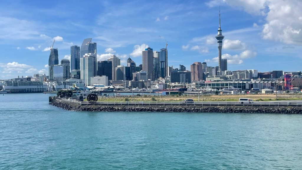
Auckland skyline
About an hour ferry ride from the city you can visit amazing wineries on Waiheke island. Several famous wineries are located on the island. The Casita Miro is a Spainish-inspired winery where you can enjoy the Miro-inspired art of the owner while you sip delicious wines….and enjoy the magnificent views of the Pacific Ocean. It is also possible to walk or bike to other nearby wineries.
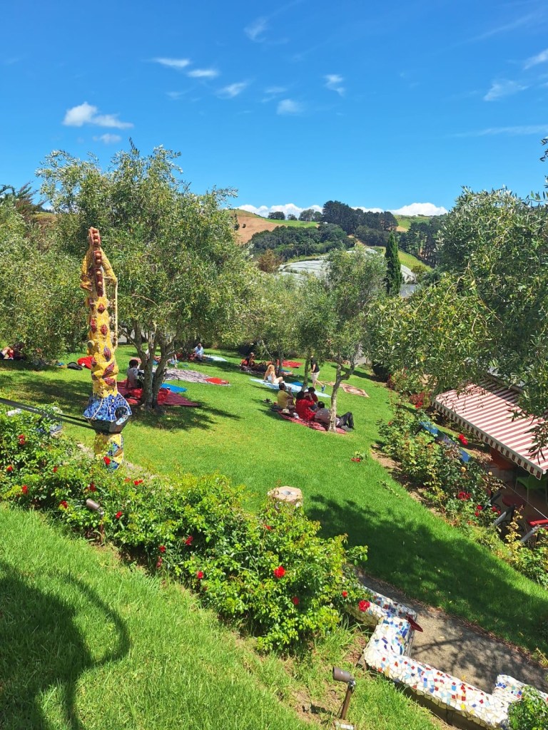
Casita Miro garden Hamilton
About 2 hours’ drive south, is the quiet town of Hamilton where you can watch the boat races and drive to the famous Waitomo, where you can visit limestone caves. As you explore the caves, the guide will show the stalagmite and stalactite formations, test the acoustics in the inner chamber. you will hop on a boat to experience the amazing glowworms on the ceilings and walls of the underground river.
Rotorua and Taupo
Maori culture is very strong and evident in these two towns. We visited a Maori Village near our hotel in Rotorua. We had one of the most invigorating hot pool experience in the- Hells Gates mud bath and spa. We were allowed only 20 minutes to lather our bodies in sulfur drenched mud, dry for a few minutes and then soak in the pools. You can spend much longer in the pools however. We took a guided tour of the village, ate corn cooked in the steaming hot waters of the geothermal springs, watched the geyser and strolled through the cemetery where graves are constructed above ground so that the bodies are not cooking in steam.

Hells gate 
Maori performance In Taupo, the geothermal springs, contain different minerals than in Taupo but they are as relaxing and enjoyable. The Huka Falls that emanates from the abundant amount of water from the Waikato River is a place one should not miss. This falls is unlike any other, we have seen, Its low in height but the millions of gallons of water cuts through a natural narrow gorge which amplifies the thunderous movement of the water. There are trails along the river for both cyclists and hikers alike.
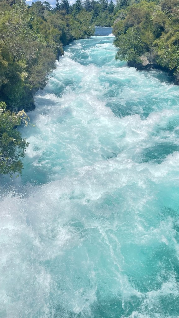
Huka falls Wellington: The capital of NZ and a port city on the south end of the north island. The city is a destination for cruise ships and where you can take the interisland ferry to the South Island.
You can enjoy exploring the cafes, bars and restaurants in this city. We tried Deluxe Cafe and we were surprised at the good quality of the coffee. We had the most delicious seafood and crab meal in the waterfrontCrabshack restaurant in Wellington.
South Island
Marlbourough Valley
On our drive from Picton ferry we stopped in the Malbourough valley—-the famous wine region, for lunch. The Cozy Cow restaurant did not disappoint; we had a great lunch and tasted a few wines from this vineyard. The Marlborough region has some of the largest wineries because of the soil and climate. The Sauvignon Blanc and Pinot Noir are famous grapes from the region.
Italian food at Cozy Cow 
Marlborough valley Lake Tekapo
On the way to Queestown, we stopped at Lake Tekapo, a beautiful lake surrounded by mountains, with an observatory and a great coffee shop.

Enjoy your morning coffee Queenstown
Located on the shores of lake Wakatipu and surrounded by beautiful mountains. It is a hub of adventure and fun outdoor activities such as trout fishing, scenic tours, trails and much more. We spend the night at a lakeside cabin on lake Wakatipu. It was unforgettable—-amazingly clear skies and peaceful. In the morning we visited the Instagram famous “ thatwanakatree” to also take some pictures for this site. In Queenstown , we hopped onto the floating bar for a drink, listen to the music and soaked in the atmosphere. We had one of the best gelato and indulge in several bars of chocolates at Patagonia —- a lakeside ice-cream and cholate shop.
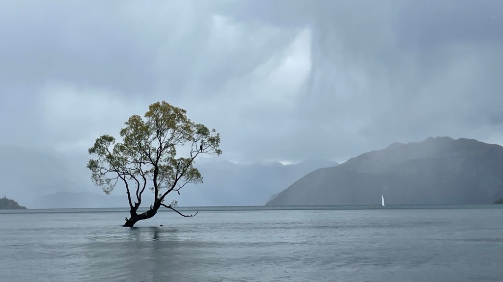
#ThatWanakatree Lavender Farm: We visited the botanical gardens, and a lavender farm and gardens. We were totally taken aback by the immensity of the plants, flowers and blooms. Everything was large and beautiful. Below are a few pictures of what we saw.

Lavender fields near Wanaka Doubtful Sound
One of the most unforgettable experience we had in NZ was our overnight cruise in Doubtful Sound. We drove from Te Anau to Manapouri where we boarded a boat that took us across the lake. Our pilot gave us a brief history lesson of Lake Manapouri including the construction of the hydroelectric station. We were then picked up by a coach whose driver provided us a narrated history of the Fiordlands and Doubtful Sound while we drove over the Wilmot Pass.
It was a rainy and cloudy day, as we boarded the Fiordland Navigator. We went through hidden waterways, saw numerous waterfalls and bottlenose dolphins. As the evening came, we dropped anchor in a quite cove for the night. Before dinner, we were invited by the captain and crew to explore the shoreline in Kayaks, boat or remain onboard the ship—-Some people even went for a swim in the frigid water. After a restful night, we had breakfast and cruise back to port in Manapouri.

One of the many waterfalls in the sound 
Kayaking in the fjord 
Waterfalls, majestic Oamaru
Oamaru is a beautiful town surrounded by mountains and ocean. It is famous for penguins and whale watching in NZ. We visited the blue penguin encounter center, which was a short walk from our hotel. They have an interactive exhibits with information about the blue penguins and outdoor courtyard seating overlooking the ocean. The seats are strategically orientated to observe the blue penguins up close as they ascend the slope each evening. The blue penguins are very small animals and maybe the smallest of all the penguins. They swim ashore in a blob of bodies, then waddle up the slope to their respective burrows. As we walked home we could see several ambling alongside the road as the excited tourists snapped pictures and video.
Christchurch
Our last stop in the South island was Christchurch the gateway city to Antartica, that host and support people and equipment for several countries. The city has a very popular botanical garden, with an expansive collection of roses, dahlias, and tropical plants.

Dahlias at the botanical garden, Christchurch Christchurch is surrounded by mountains, has accessible beaches and is well connected to Australia by air. It is an enjoyable place, with many things to do and see, whether you like the outdoor or the city life.
-
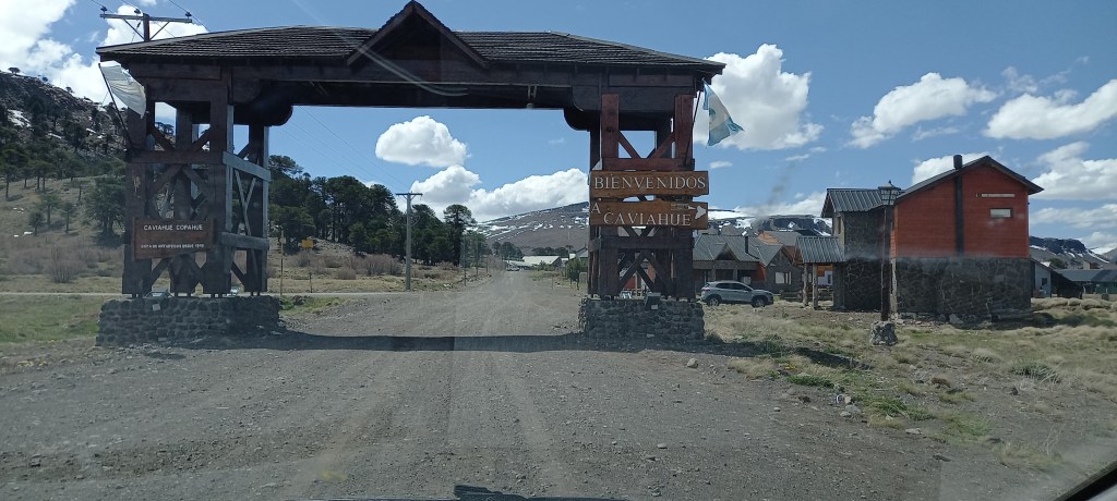
From Caviahue to Bariloche
After the delightful days in Caviahue, it was time to get back on the road. We had a good drive ahead to San Martin de Los Andes, and then to Bariloche.
Leaving Caviahue, we backtracked all the way back to Route 40, then headed south. The drive to San Martin de Los Andes was uneventful, the road in good conditions. It was cloudy and we could not see Volcan Lanin, what a shame!
We arrived in San Martin de Los Andes, found our accommodations, got some food ( thanks PedidosYa!), and rested. Then we noticed snow blowing and the skies darkening. It was a storm that lasted for 2 days, delaying our departure to Bariloche. Road conditions in the spring change rapidly, and it is best to stay safe.
Sudden snow 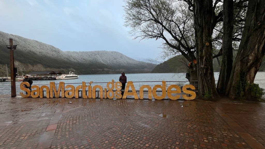
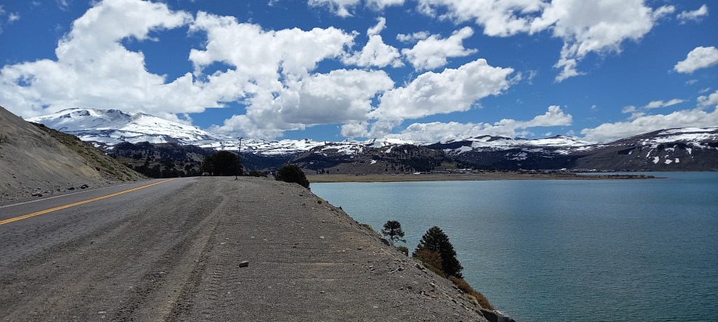
San Martín de Los Andes is a town in Neuquen, by the shores of Lake Lacar. Nearby there is a sky resort (Chapelco). The town is quite beautiful, lively and with plenty of shopping and food opportunities. It is the gateway to the ‘Ruta de los 7 Lagos’ and the Nahuel Huapi national park.
The ‘7 Lagos ( 7 lakes)’ is a scenic road that starts in San Martin de Los Andes. There are lookout points everywhere, plenty of traffic and sometimes animals on the road. Caution is advised.
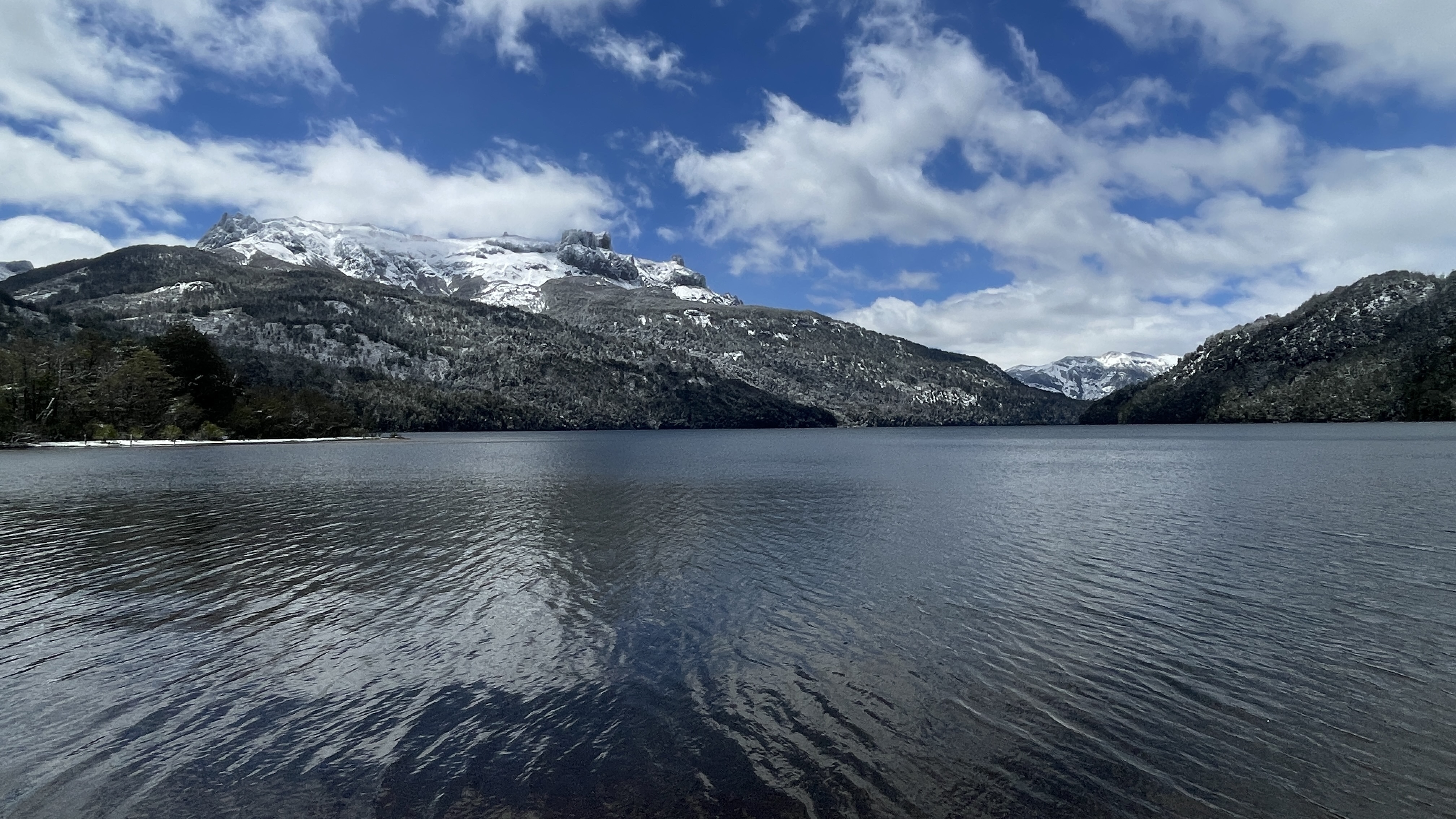


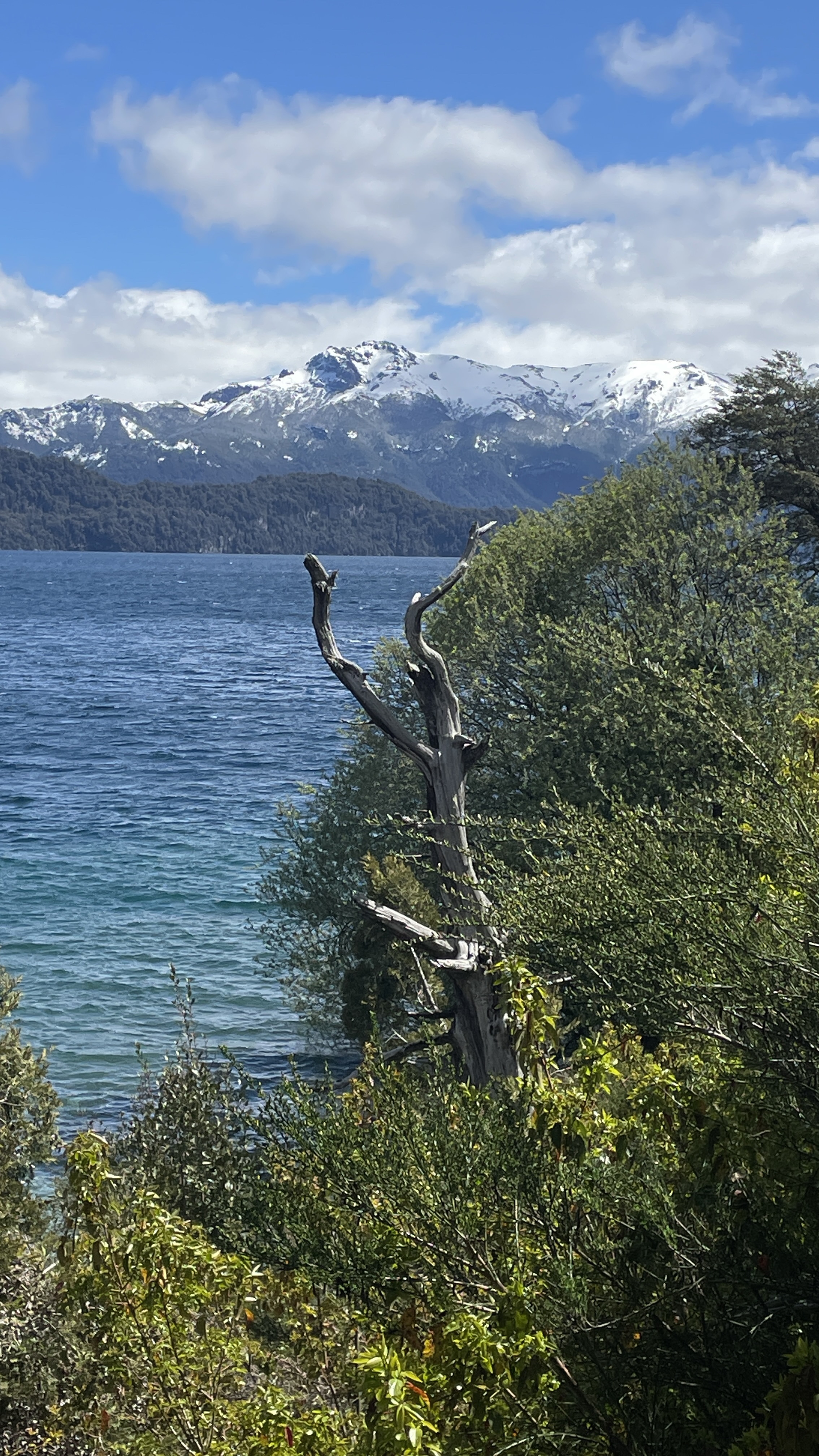
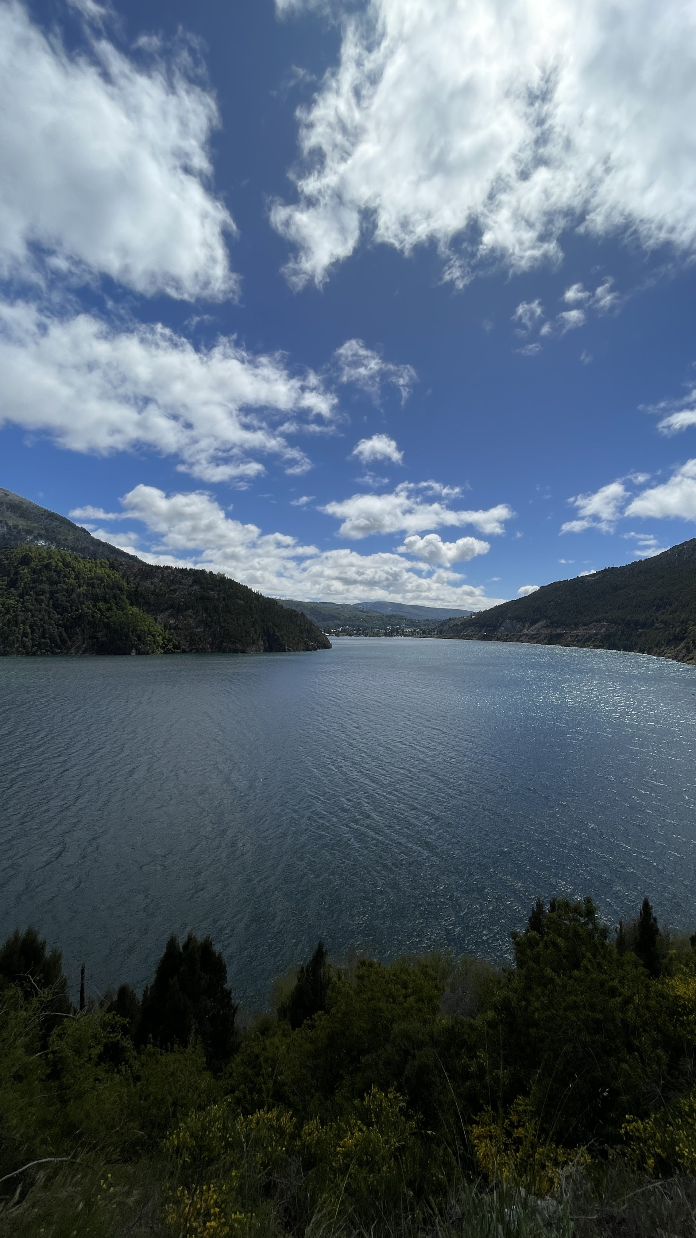

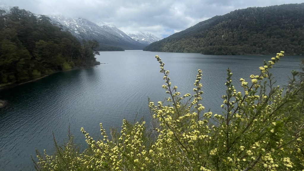
The first town we reached is Villa La Angostura, which sits at the shores of Lake Nahuel Huapi. This lake is huge, an Bariloche also sits by the same lake. Massive bodies of water.
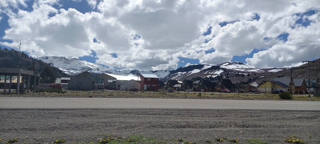
La Angostura is a charming town, great for a pit stop and gift shopping. The road was excellent, so we continued to our destination, Bariloche.
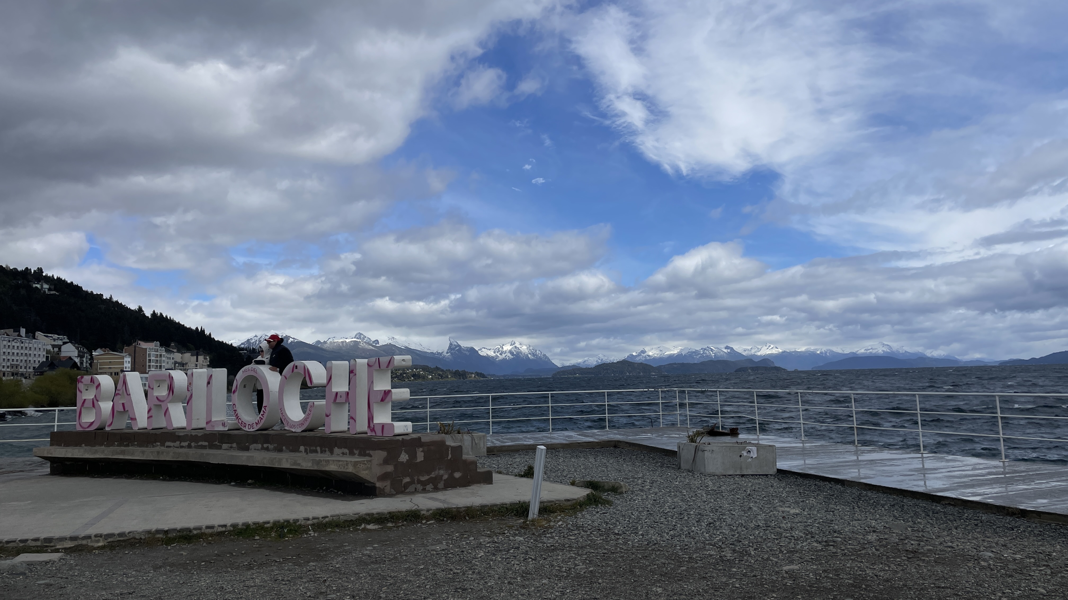
Bariloche for many is the gateway to Patagonia, well served by flights from Buenos Aires. It is a town that has grown significantly due to the tourism industry. The town spreads along the slopes by the lake, so it is quite hilly. During our time in Bariloche it was quite windy, so we stayed in town and did not get a chance to partake on some of the wonderful hikes around.


Tips:
- Monitor the weather forecast and road conditions. Snow and wind combined can make for hazardous road conditions.
- Visit the Rapa Nui store in Bariloche. It has great chocolate, ice cream and even an indoor skating rink! The hot chocolate is superb.
- Be prepared for changing weather, and have fun.
Walk good,
Alex
-
A Day in Caviahue
We awoke early and excited for the trip to the volcano. We had a choice, hike sixteen kilometers or go by dog sleds. We chose the latter and were not disappointed. We had eight mushers pulling our sled. Porter the lead was great. He had earlier introduced himself boldly on the drive up from the town. Periodically our guide Javier had to roll down the windows because porter was releasing himself of accumulated gas from prior day’s meat meal.
Porter leading the pack
We crossed two frozen lakes, passed a hydrothermal installation for steam and electricity as we headed for the peak of the volcano. We arrived at the Chilean border and our destination. A place that is the embodiment of peace, beauty and majestic views.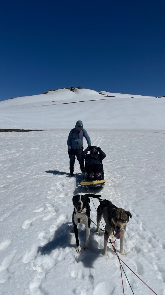
Relaxing before heading back 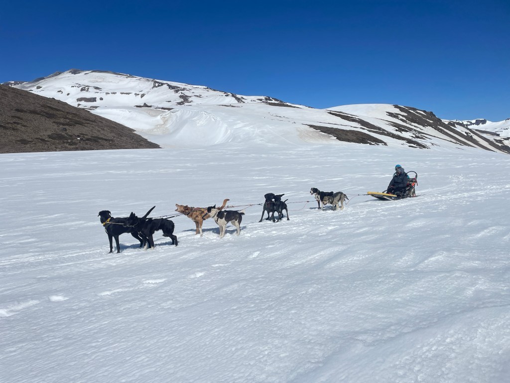
Our mushers were top notch 
X-5 point, border of Argentina and Chile On our way back to town, we stopped at an old military compound literally on the edge of volcano Copahue. We were treated with the most exhilarating mud lake bath ever. In a pool of hot mud and boiling water we soaked, swam and scrubbed. You actually felt the soft, hot mud from below slipping under your feet with every step. We spent nearly an hour in this glorious and natural spa alone, breathing sulfurous steam and soaking in the views. We emerged when another small party and their guide appeared. We felt refreshed, energetic and ready to continue exploring Route 40.
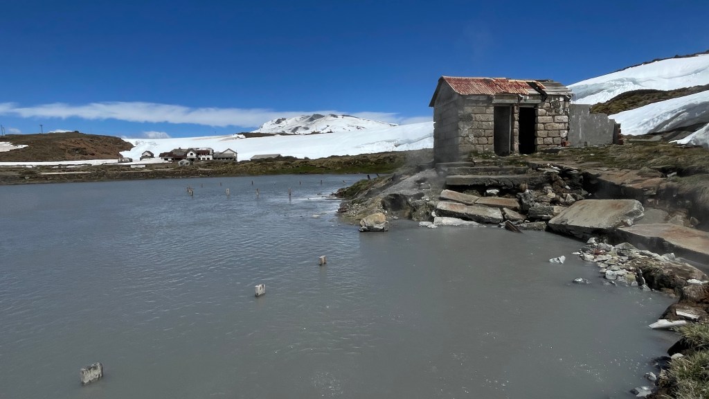
Hot mud lake 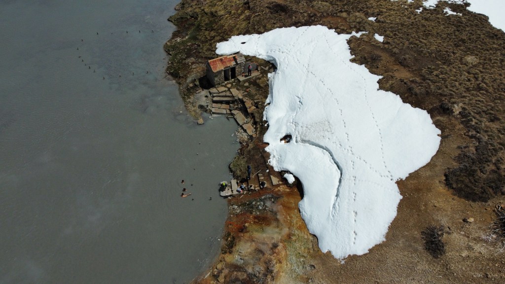
Aerial view of the mud lake area 
Mud lake with Volcán Copahue in the background TIPS
1. Summer is hiking season. You can hike to the Volcano and all the way to the border with Chile.
2. Copahue is the town with many hot springs. It is open December 1 to May 1.
3. For the wild mud lake, you need permission in Las Máquinas.
Until next time,
Walk good
-
Discovering Caviahue
We started the day with perfect weather in Caviahue. Our first destination, the Salto del Agrio waterfall. It was an amazing sight and exceeded our expectations. The landscape was magical, it was hard to leave. Framed by snow-capped mountains and watched over by a lonely auracaria (pehuén) tree, the waterfall is majestic.
Copahue Volcano 
Agrio river waterfall 
Agrio river waterfall 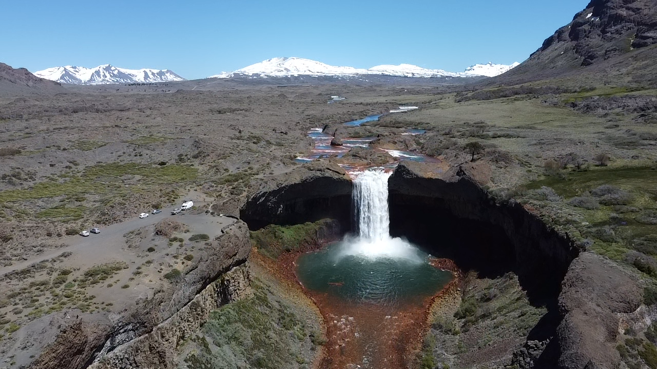
Agrio river waterfall
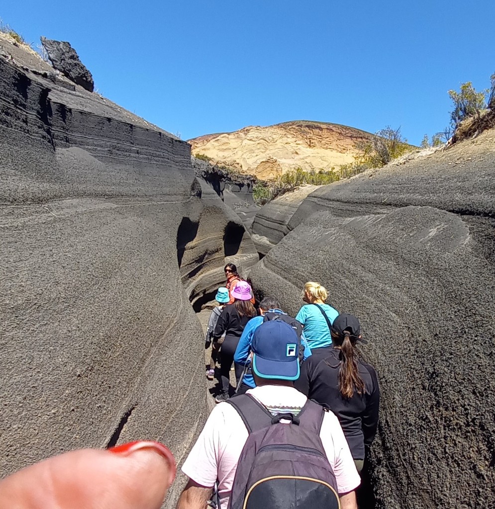
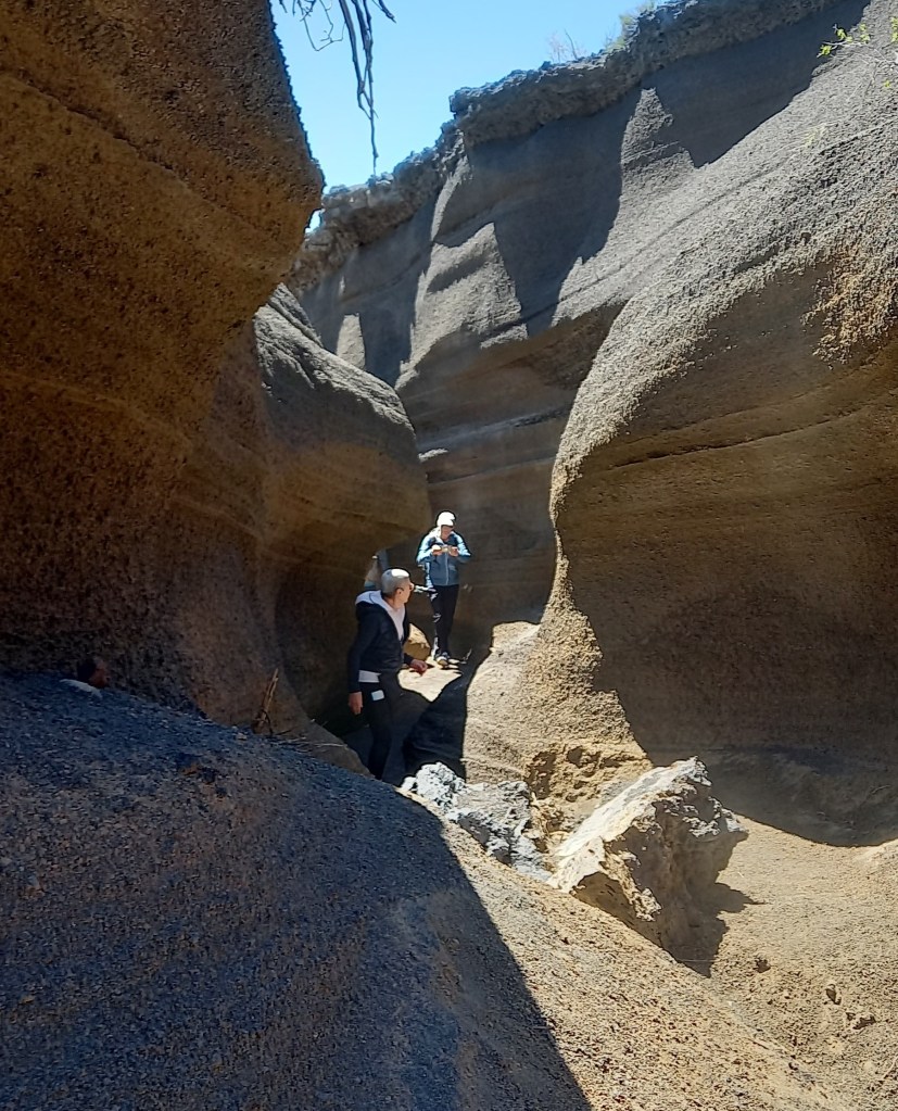
We left the waterfall, and drove towards Copahue. The road is opened to Las Máquinas, where we walked among pools of boiling mud and steam vents spewing pungent sulfur smell, surrounded by snow. Caviahue evokes a sense of adventure, with so much to see and do.
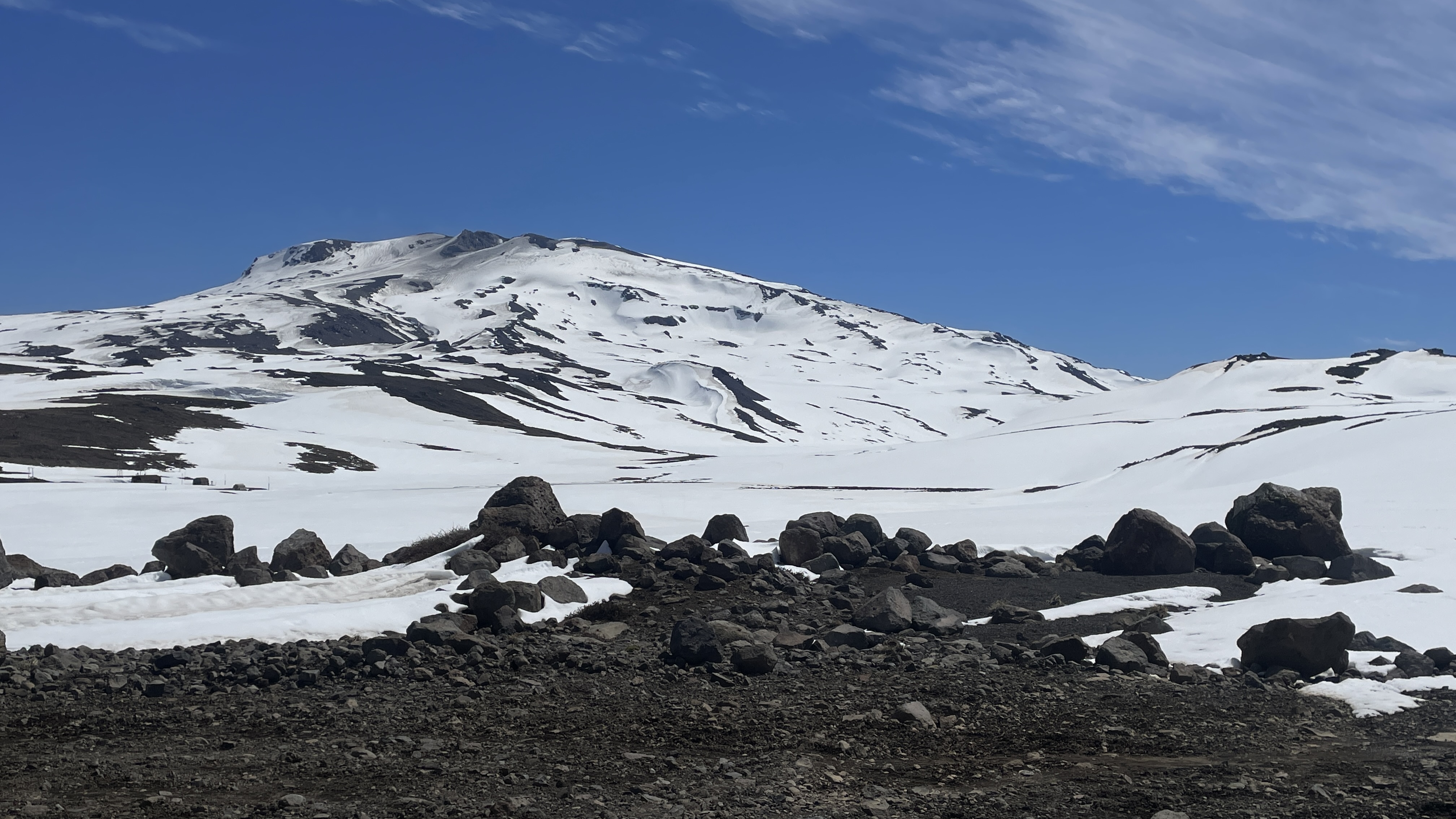
Copahue Volcano 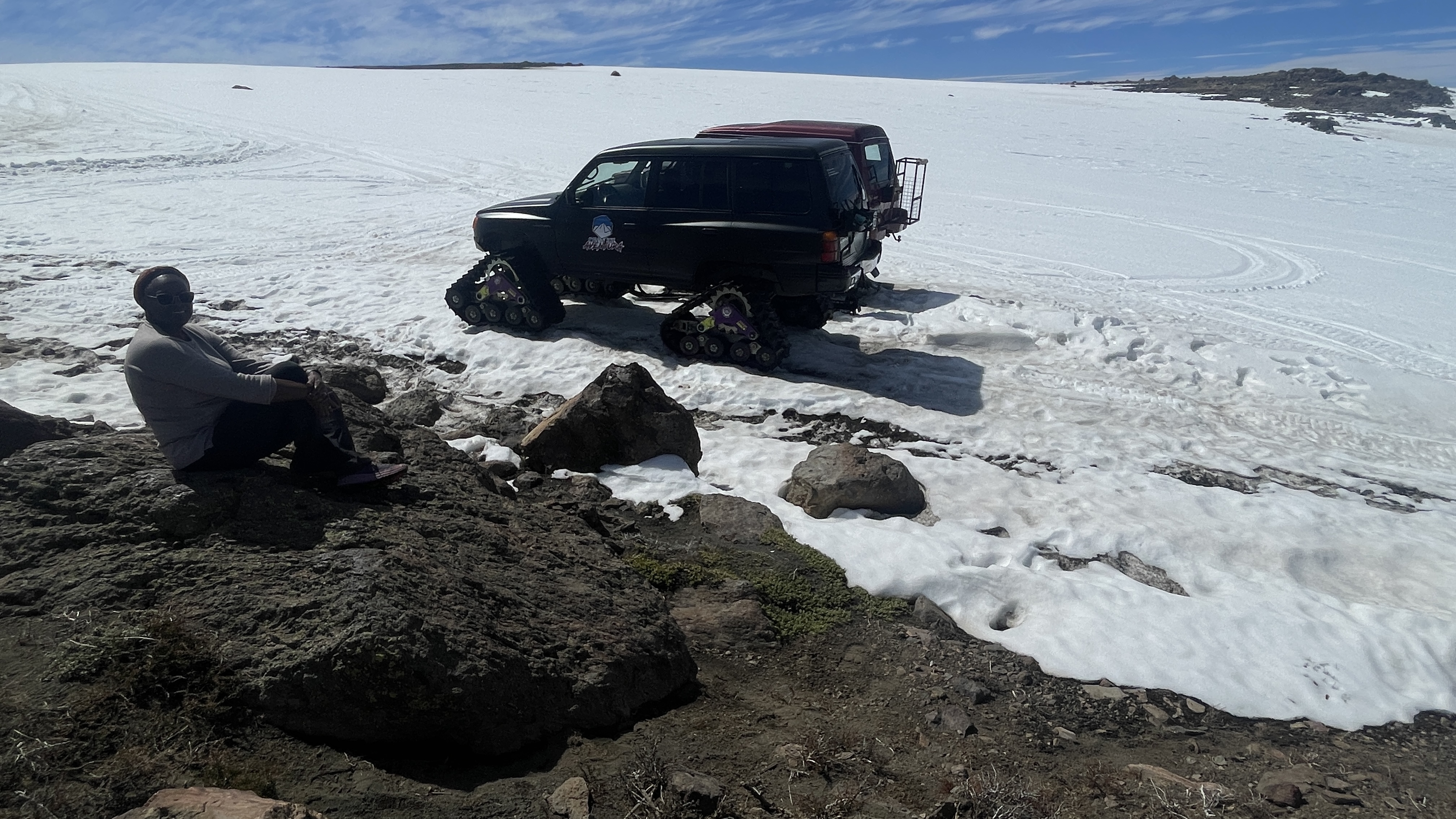
Snow-ready trucks Snowmobile 
Snowmobile and friends 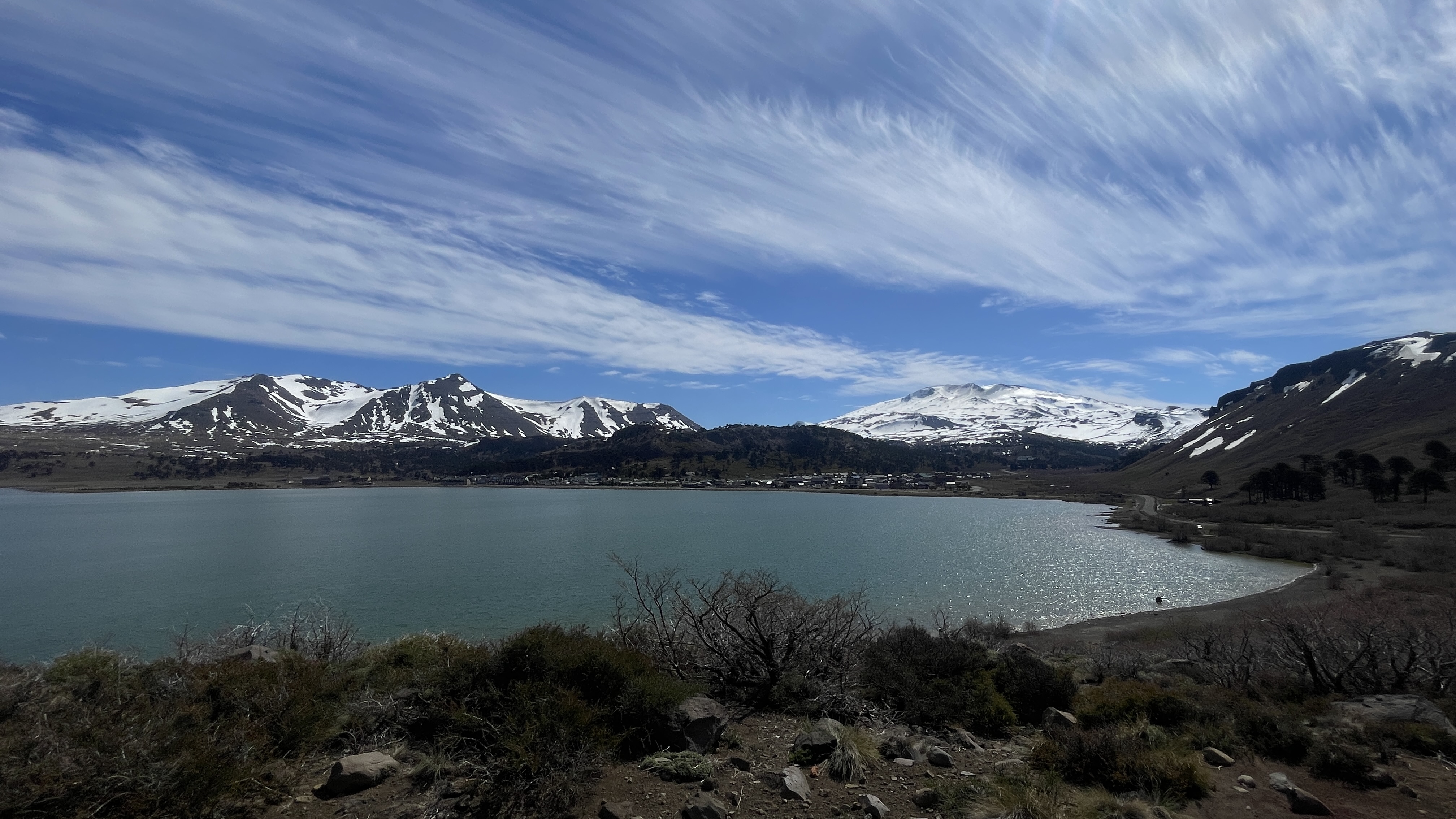
Lake Caviahue
-
Malargue to Caviahue
We enjoyed an exhilarating hike into volcano Malacara in Malargue. This volcano had rivers of lava that solidified as magma erupted in water over 450 thousand years ago.
Exploring Vulcan Malacara in Malargue, Argentina We continued the drive south and stopped for a short hike in Manqui Malal to see the angel hair waterfall and hunt for Amnonites (fossils) by the river. It was a fun and educational activity. We were rewarded with several fossils finds.

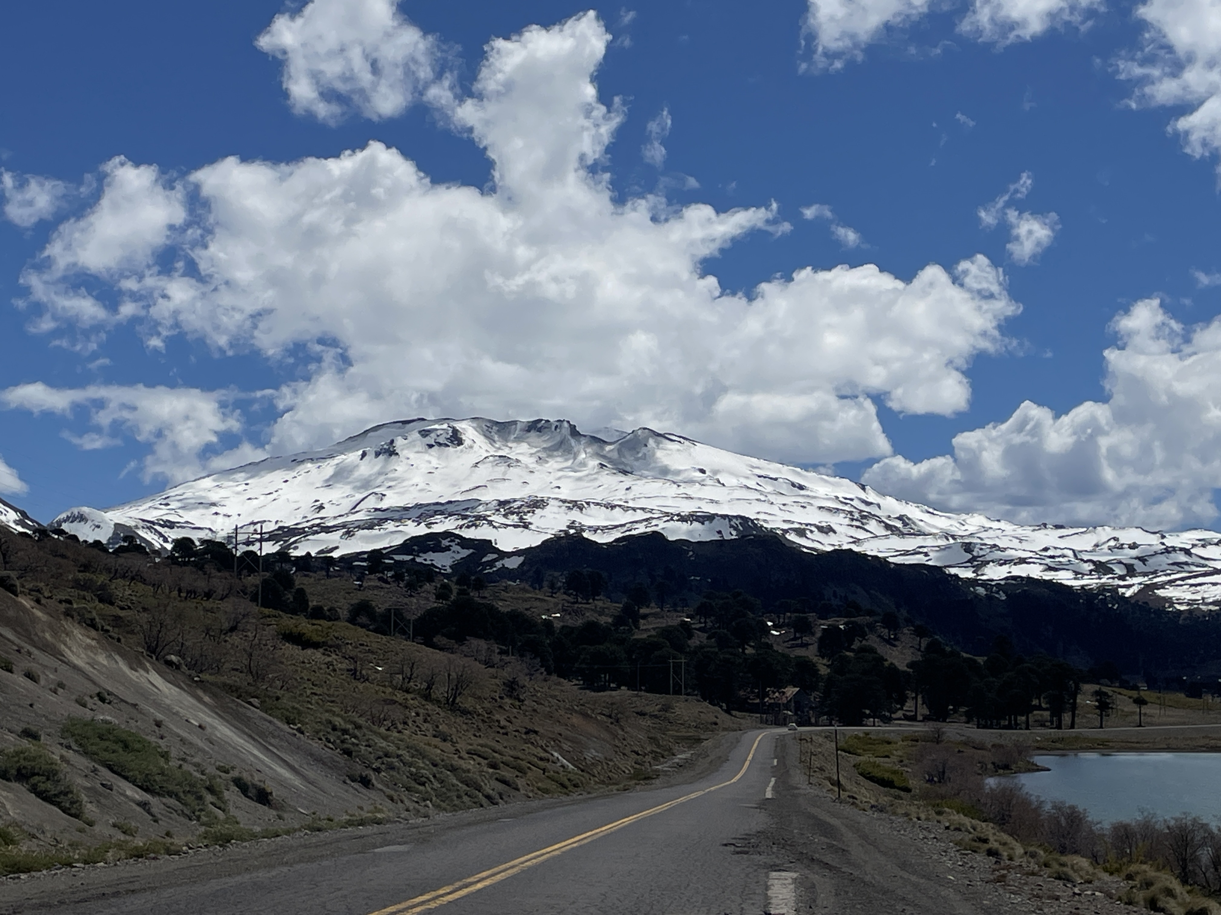
Fossils Find in Manqui Malal Argentina We continued over 80km on mostly “unpaved highway” then crossed the river Barancas into Neuquén province and drove to the beautiful town of Chos Malal. A Patagonia frontera town Chos Malal lies between the Curri Levue and Neuquén rivers. The town has amazingly beautiful landscapes and an abundance of roses of almost every color and huge blooms. After a peaceful rest in the hotel Terra Malal, and a gem of beauty and tranquility we continued south.
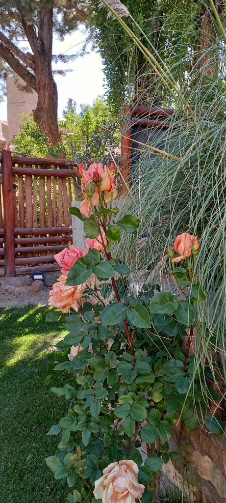
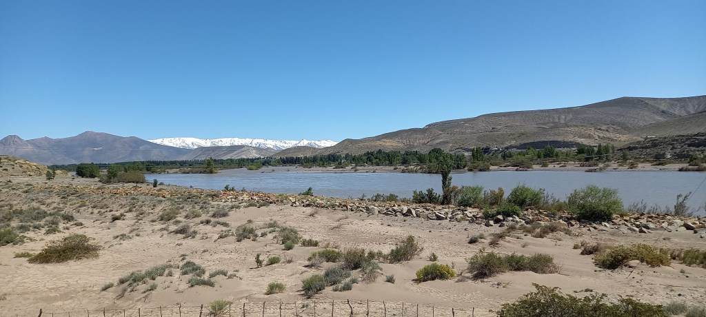
Rose blooms and Neuquén River in Chos Malal Argentina A short detour took us to Caviahue. The home of fresh trout, located by lake Caviahue and the foothills of volcano Copahue. We will stay here a few days.
Until next post, walk good.
-
Peru-Puno to Arequipa
We left Copacabana and after about two hours by bus we arrived in Puno Peru. Puno, like Copacabana in Bolivia sits on the Peruvian shores of Lake Titicaca. Its economy is primarily agricultural and livestock (llamas and alpacas) based. The town is famous for its access to the floating man-made islands on lake Titicaca. We spend only a short time in Puno and soon headed on our road trip to Arequipa.
Arequipa City-After several hours of driving in the dark we arrived in Arequipa. We got off the bus into a taxi and headed directly to our Airbnb for a well needed rest. The next morning when we awoke and looked outside, we observed this giant mountain that appeared to loom immensely over the city scape, It felt so close to us. We did not expect this, so we inquired and were told that is Misti. Misti stands at 5,822 meters or 19,101ft above sea-level and forms part of a series of volcanoes in that region of Peru. The entire city scape and concurrent culture of the city is dominated by the presence of this mountain.
The city has a Spanish colonial era layout. The main historical center consists of a central plaza, surrounded by the Basilica Cathedral, shopping, restaurants, museums set off by lovely palm tress and other ornamentals. This is where you will find the locals gather to listen to music, sale their wares and air their grievances by protesting. The Santa Catalina Monastery is a major attraction in Arequipa. small city within the city.

Sunset in Arequipa This very popular monastery is a small self contained city that was founded in the late 16th century. It consists of many cramped but charming streets lined with tiny colorful, houses. These houses we learned, were inhabited by the nuns that lived in the monastery centuries ago. As we wondered around streets, we realized we were exploring a very old but well designed city of plazas, fountains, and cottages. The internal spaces in many of the cottages were creatively designed for the outside light to filter inside. As we prepared to complete our tour, we wondered into a lovely garden, it was like stepping back in time. A space which appeared intentionally designed for serenity and tranquility. It had seating, and planted with flowers and several types of fruit trees.
Over the ensuing two weeks, we immersed ourselves in the food, music, and the culture of the city by walking and hiking around the city. We found Tipika restaurant to be a welcoming and friendly place were you could have tasty meals for a resonable price. We absolutely enjoyed the chicharron de chancho Arequipa. we were impressed by the variety of fruits, meats, food and vegetables for sale in the market. The market was like no other we had encountered. Two memorable moments for us in this beautiful market were having our heads measured for customed felt hats at Elyca Sombrereia and drinking fresh juice from the juice bars.

Chirimoya Visiting Colca Canyon

View of eruption, from Colca canyon -
Driving south:El Salto to Malargüe
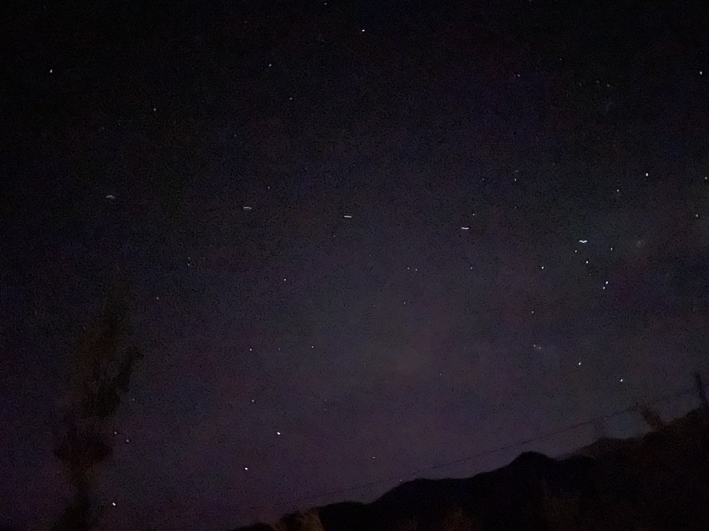
Driving away from El Salto was difficult. Its that place in the Andes, where families come out in droves on a beautiful spring day, they gather some river stones to protect the fire for the asado as they serve red wines from the backs of their pickups. When the sun sets and darkness rolls in they drink their mate and watch the stars shine brightly and the many satellites stream across the night sky.
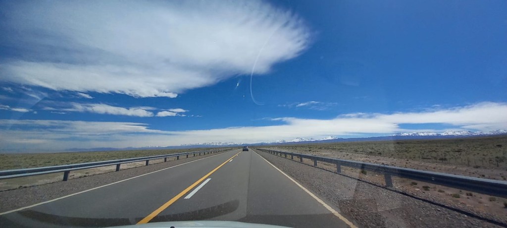
Satellite formation, El Salto We are driving down route 40, and the southern spines of the Andes. Big sky country, four and a half hours to Malargüe, a touristic town known for its historic dinosaur finds. The road is endless and with wide open views of the snow-capped Andes mountains. The range seems to end, yet every turn on the road , new mountains appear. We passed huge fields of garlic, grazing cows and sheep and arrived at our hotel with a front yard filled with sheep.
Open skies 
The Andes with fields of garlic in the foreground 
Happy sheep -
Mountains to Lake: Road Trips in Bolivia
After spending a memorable time in high altitude La Paz, we embarked on a road trip to visit the Bolivian side of Lake Titicaca. The experience was unimaginable to us. The drive was filled with excitement and anticipation while also exhilarating and uncomfortable at times. Mostly, we were in awe of the places we visited; the alluring warmth, the charm and the friendliness of the people we met along the way.
After a long taxi drive in the unpredictable La Paz traffic, we arrived at the bus station for the start of our bus trip to Copacabana. The bus trip was mostly uneventful and we slept. I was awakened by the driver telling everyone we must all disembark from the bus with only small personal belongings to catch a boat to cross the lake.

Although I was told this would happen before, somehow, it didn’t quite register in my consciousness. Nevertheless, we climbed down from the bus and were shown a small Kiosk where we were instructed to purchase a boat ticket to the other side of the channel. It felt surreal as we climbed into the small boat and were whisked across the lake to the other side in about 10 minutes. We disembarked and wondered around the small lakeshore port of Tiquina. Some passengers went off to browse the stalls while others took pictures.

After about 20 minutes our attention was drawn to the lake and the approaching barge. To our surprise, our bus was perched precariously on top of the barge. It was a strange sight, so we gathered around to capture this incredible photo of our bus crossing the lake on the barge.
The trip continued, until we eventually reached Copacabana. This lakeshore town is located on the south shores of Lake Titicaca. It is from here that many scheduled trips on boats sail out to the sacred islands of Isla del Sol and Isla del La Luna. The town has several restaurants, coffee shops and tourist shops and stalls. We proceeded to the kiosk to purchase our tickets to Isla del Sol.
The boat took about two hours to get to Isla del Sol. As we approached, we saw a steep rocky island in the middle of the lake with several ruins and agricultural terraces climbing up the slope from the port. When we disembarked, we were met by our transport, a donkey and its lady driver and our Airbnb host. There are no motor vehicles or paved roads on the island and so you must walk everywhere. Our suitcases went with the donkey and we proceeded to climb up the many steps leading up from the port.

Arriving on Isla del Sol 
Teodora with Camacho 
Steps up from the port We arrived at our cabin, and were rewarded with one the most spectacular views you could ever imagine. The varied blue colors of the lake against even bluer skies and the snow-capped Andes mountains was absolutely divine. We retired to bed early after our tasteful and well deserved meal of local lake trout. Over the next three days we basked in the untamed beauty and serenity of the island. We enjoyed absolutely amazing sunrises, sunsets and views of the impressive Lake Titicaca and snow-caped Andes from our bedroom. Because of the altitude, we avoided any intense hiking but took time to explore a bit of the island. We were well cared for by Teodora, who made sure someone brought us breakfast on the days she was travelling to Santa Cruz for a wedding. Teodora even provided us with fresh muña muña from here garden to help us alleviate the symptoms of altitude sickness (Isla del Sol is located at 13,045ft above sea level). Sadly, due to mounting symptoms of altitude sickness, we curtailed our stay and headed out earlier than planned to Puno and then onwards to Arequipa, Peru.

Terrace slopes for growing crops 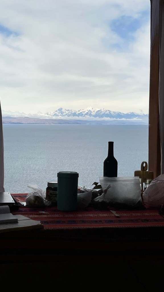
View of snow-capped Andes from our cabin 
Sun Palace Ruins Isla Del Sol has a rich history, we share these few pictures to give only a miniscule view of the island .
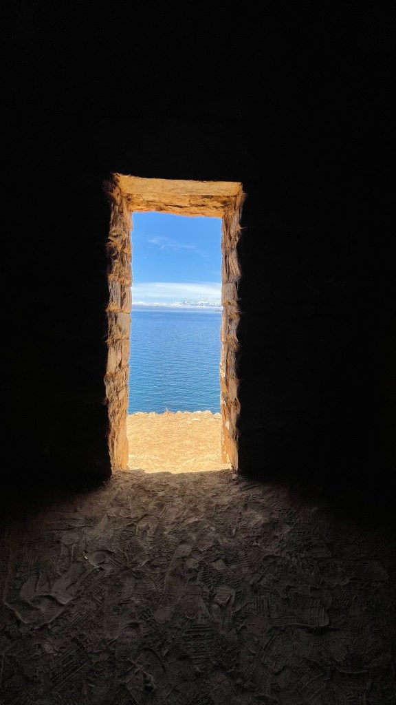
View of the lake and Andes from the Sun Palace ruins 
Sunrise on Isla del Sol Tips for travelling by bus to Isla Del sol
- Bus and boat trips are not the most comfortable, there are plenty of bumps and jerks so travel with medicine if you get sick easily.
- There are not many options for housing, we highly recommend Teodora’s place (Cabanas Ecologicas Santo Campo) in Aribnb. Book your overnight accommodations early or before arrival on the the island.
- Internet and Wi-Fi connections are spotty or limited so be prepare you might be disconnect during your stay. Local Telecom provider Entel has service in the island.
- You must pay for entry to the island, about US10.
- The locals do not like to be photographed so be aware of this, they will let you take a picture with a llama for a fee.
- There are no roads and your accommodations might be a steep climb from the port if your accommodation is further up the island. I recommend that you travel light to Isla del Sol.
-
We are back!!!
The last quarter of 2022 was an extremely busy time for us. We spent November and December travelling in Bolivia, Peru and Argentina ( we will post some highlights from those experiences later). We arrived back in the US in mid December to spend the holidays with our family in NYC. In January, we took a break from the cold and dreariness of NYC to visit Spain and Portugal.
We arrived back in Seattle primarily for a legal case against the University of Washington. Although the outcome was not in my favor, I remain convinced I achieved an important goal that brought to the public light some personnel practices at the institution.
Bolivia, like its neighbor Paraguay, is a landlocked country in South America. It shares borders with Argentina, Brazil, Chile, Paraguay, and Peru. The two most populous cities in Bolivia are Santa Cruz de la Sierra, a large city located in the eastern tropical lowlands and La Paz, a mountainous city located on the altiplano. One of the most striking observation for me in Bolivia was the drastic change in climate from Santa Cruz to La Paz. One moment we were uncomfortably hot in the humid lowlands, few hours later we were freezing in the dry cold of La Paz Department.

Rapidly growing Santa Cruz 
Annato seeds used for cooking, Santa Cruz Transportation across the city of La Paz is challenging. There are no obvious logic or reason to the manner of driving especially among the cars and taxis. One can easily get bogged down in this type of traffic for hours….not desirable with limited time. An amazing array of cable cars can be seen dotting the entire cityscape to alleviate this transportation nightmare. This organized collection of cable cars forms the backbone of an urban transport system affectionately named “Mi Teleferico“. For a few dollars, you can enjoy some breathtaking sights from up high. This is a delightful way to view the snow caped mountains and undulating and alluring terrain of La Paz city. Although, to experience the array of tastes, scents and hospitality of the people in this awesome city, you must do some walking around in the neighborhoods.
La Paz has a rich and eclectic mix of peoples, customs and cultures and this represent the multiethnic and multicultural diversity within Bolivia. Although a large number of Bolivians have European ancestry, the majority of Bolivians have indigenous ancestry and self identify as mestizo, a mixture of Hispanic and Amerindian cultures. The colorful dresses of the Quechua and Aymara are dominant in the countryside and high altitude places such as Copacabana, Bolivia, and Isla del Sol in Lake Titicaca. This makes Bolivia an interesting place to explore and learn about some of the oldest cultures in the west.

View of La Paz business district 
Mi Teleferico, Green Line 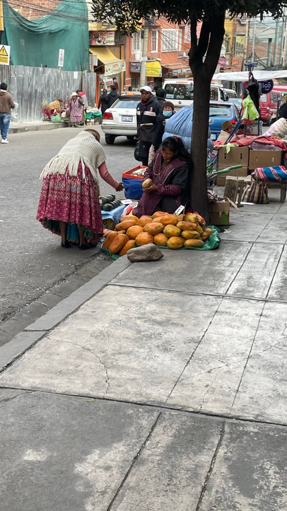
Fruit vendor, La Paz 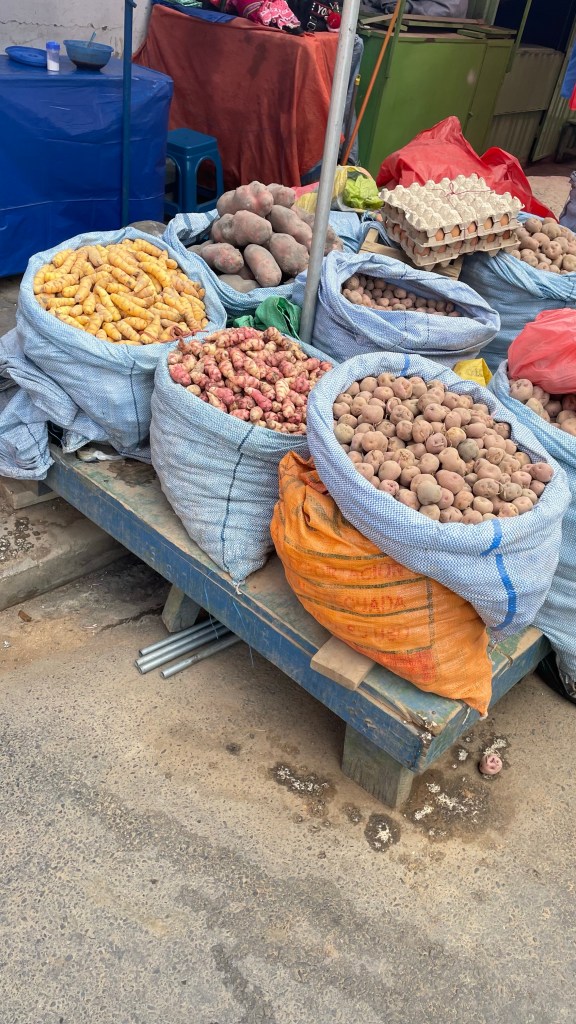
Potatoes and roots , La Paz 
Transformer’s style in La Paz 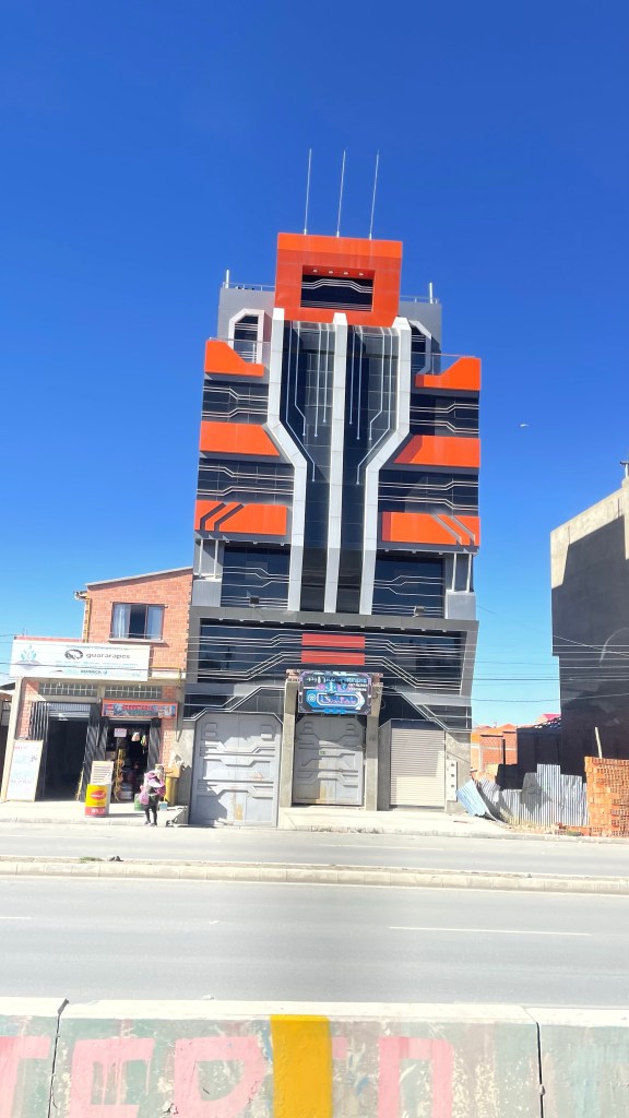
Transformer’s style in La Paz 
High cuisine in La Paz @ Gustu Tips for visitors to Bolivia
- Travel everywhere with bottled water for drinking and brushing your teeth.
- If you plan to visit the high cities of La Paz, Copacabana or Isla De Sol in Lake Titicaca be prepared with medications to cope with the high elevations ( altitude sickness).
- Road transport in Bolivia is challenging, plan ahead and be flexible with your time. If time is limited you can get a high up view from the cable cars in La Paz.
- US citizens are required to get a entry visa to Bolivia. The cost of this visa is US$160, valid for 10 years. You can get the visa upon arrival to any port of entry.
- Everyone needs to show an exit ticket (bus/air) from Bolivia upon arrival to a port of entry.
- Travel everywhere with bottled water for drinking and brushing your teeth.
-
Jujuy: getting closer to the sky
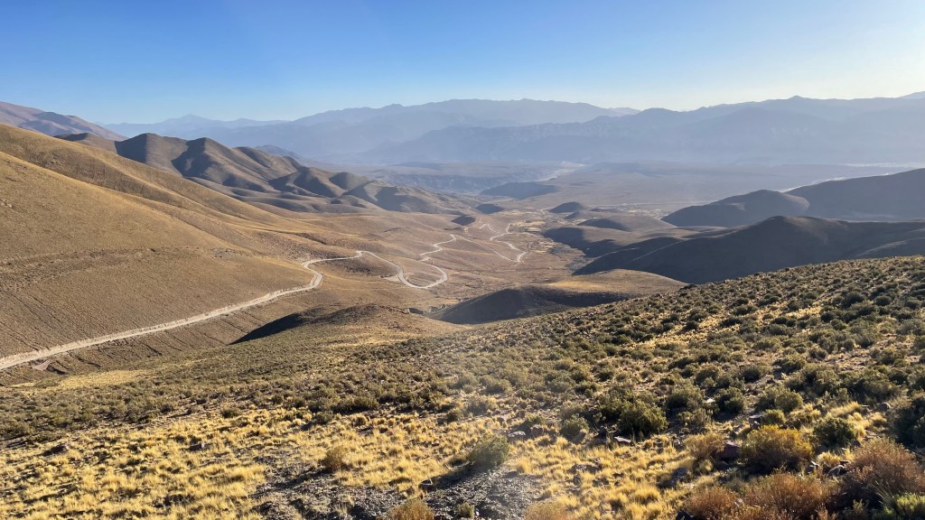
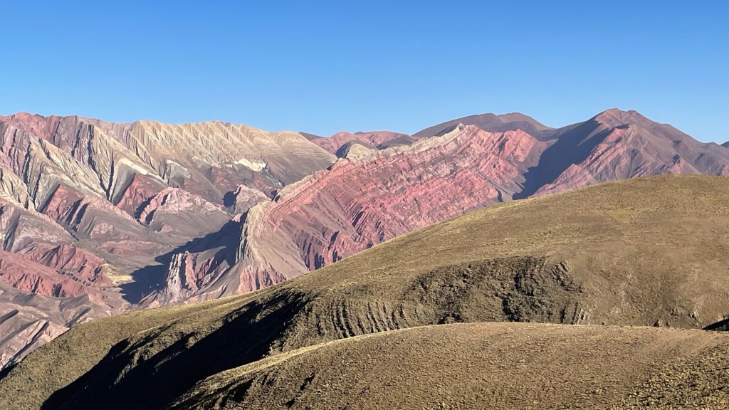
Jujuy is a northwest Argentina province with remarkable landscapes. On this trip, We followed Route 9 headed toward Purmamarca and the Mirador de Hornocal, also known as ‘the mountain of 14 colors’. To get there, we negotiated a 25 km stretch of gravel road past Humahuaca. This road reaches Hornocal and, continues to other settlements deep in the hills.
When we finally arrived at Hornocal, we were at 4350 meters above sea level, 14271 feet. You could immediately feel the effects of altitude as the short walk to the lookout point was strained, a combination of altitude and cold winds. Notwithstanding, It was an unforgettable experience. The presence of nature in its overwhelming magnificence was difficult to ignore.

We continued our journey into Purmamarca, a small town situated off Route 52, which reaches all the way to the Chilean border. Purmamarca sits right next to very colorful hills, and hosts many tourists from all over the country and the world. The market around the main square bustles every day as the tour buses comes through. The town is the gateway to other parts of the Altiplano, like the Salinas Grandes.
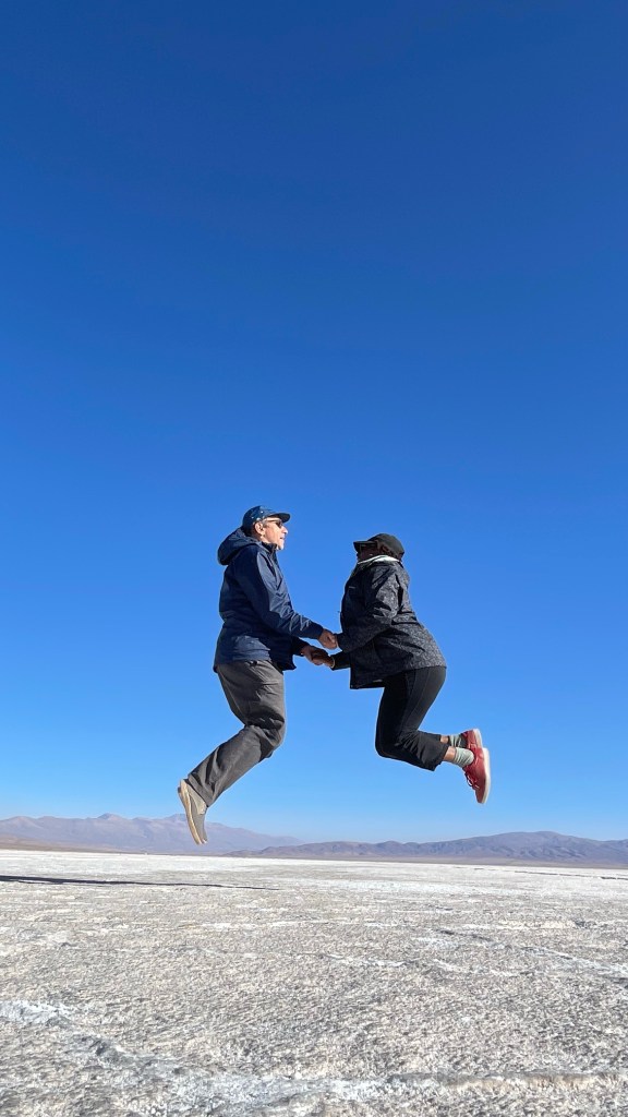
Driving from Purmamarca to the Salinas Grandes was an exiting day trip. The road is in great condition, the landscapes change constantly, and you get the feeling you are entering a very special area. There are villages at the edge of the Salinas, and the people help guide your visit unto the Salinas.
The clear skies and bright white salt provide a contrast that is unique and exciting to experience. To see salt blocks being used for construction was unexpected. A major trade road crosses the salt flats and connects to the Pacific port of Antofagasta in Chile and on to Paraguay and Brazil. The large trucks that traverse this region provide a small glimpse into the complexities of moving goods between countries.


TIPS
- Visit Juan Chani at El Meson in Purmamarca. You will have a great meal in a welcoming space.
- Mirador de Hornocal closes at 6pm. Plan your trip accordingly. The road is best driven with daylight.
- You will need a guide to enter Salinas Grandes. They are knowledgeable and happy to take your pictures. Cost of entry is $1500 argentine pesos per car ( September 2022). Well worth it!.
- Route 52 is in great shape. A true joy to drive it at sunset. Until next time.
Walk good
-
Subscribe
Subscribed
Already have a WordPress.com account? Log in now.

.JPG)